Over 12 Inches of Snow Possible in Parts of Illinois By Christmas
Someone out there is in trouble. They wished way too hard for a white Christmas, and now it looks like blizzard conditions are possible for a big part of the midwest leading into the holiday weekend.
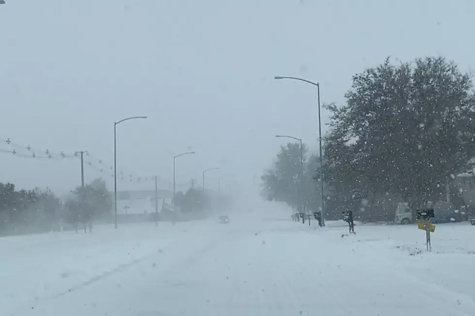
According to the current forecast from the National Weather Service, a Winter Storm Watch is in effect for the entire northern half of Illinois beginning on Thursday evening (12/22) and continuing through late Friday night (12/23).
Traveling will be dangerous throughout northeast Illinois during the peak of this winter storm with the possibility of white-out conditions and "zero-visibility at times", according to the NWS.
With rapidly dropping temperatures and expected wind gusts around 55 mph, power outages are possible and wind chills could be near -25 below zero. The National Weather Service warns that "Windchills of this magnitude can cause frostbite on exposed skin in as little as 30 minutes."
Snow accumulation will be significant in some parts of Illinois with Rockford expected to get between 2 and 6 inches, and in Chicago 9 to 16 inches of accumulation is possible by Friday night.
Temperatures in Rockford will be bitter cold with lows on Thursday night around 4, and the high on Friday expected to be around 9. Lows on Friday night will be around 0, and on Christmas Eve night it will drop to -8 below zero.
Christmas Day is expected to be sunny with a high around 10, and then up into the 20s by Monday (12/26).
The current forecast from the National Weather Service has temperatures rebounding into the lower 40's the week after Christmas, but another chance of snow is coming heading into New Year's Eve and January 1, 2023.
LOOK: The most extreme temperatures in the history of every state
Gallery Credit: Anuradha Varanasi
LOOK: The most expensive weather and climate disasters in recent decades
Gallery Credit: KATELYN LEBOFF
More From Rockford's New Country Q98.5