Illinois Earthquake Felt Across the State This Morning
A whole lot of shaking is going on in central Illinois this morning, as a 3.8-magnitude earthquake struck Ohlman.
READ MORE: What You’re Supposed to Do If an Earthquake Hits Illinois
The Location of Ohlman: A Central Illinois Shaking
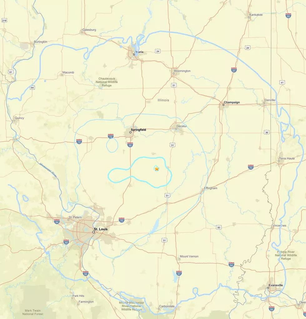
If you're wondering where exactly Ohlman is, you're just like me, because I had to find it on the map too. Located about 60 miles southeast of Illinois' state capitol, Springfield, the tremor could be felt as far east as Terra Haute, Indiana, and as far west as St. Louis, Missouri.
The earthquake made things rumble in Peoria and Carbondale. It's early in 2026, but today's earthquake was labeled "significant" by the USGS, which said these types of quakes are "determined by a combination of magnitude, number of Did You Feel It responses, and PAGER alert level."
Understanding the New Madrid Seismic Zone
The area in which Ohlman sits is in the New Madrid Seismic Zone, which the Illinois Emergency Management Agency refers to as a "150-mile long fault zone spanning four states in the Midwestern United States. The NMSZ lies within the central Mississippi Valley, extending from northeast Arkansas, through southeast Missouri, western Tennessee, and western Kentucky to southern Illinois."
READ MORE: How Common Are Earthquakes in Illinois? More Than You Think
The Impact of the 3.8 Magnitude Earthquake
While today's 3.8 scale earthquake was felt in many cities and towns across the state, it didn't do any damage. As a matter of fact, 3000 earthquakes have been recorded in the NMSZ, and not one has exceeded 5.0.
An earthquake on the scale of 8.0 must be at least 7.0 to be described as "major," which usually accompanies serious damage.
LOOK: The most expensive weather and climate disasters in recent decades
Gallery Credit: KATELYN LEBOFF
Emergency and Disaster Preparedness - How Ready Are You?
Gallery Credit: JD Knight
More From Rockford's New Country Q98.5