
Stateline Rainfall Estimates From Wednesday Night’s Storm
If it seemed like it we received more rain on Wednesday night than in recent memory, you were right. The official rainfall totals are out, and the numbers were big.
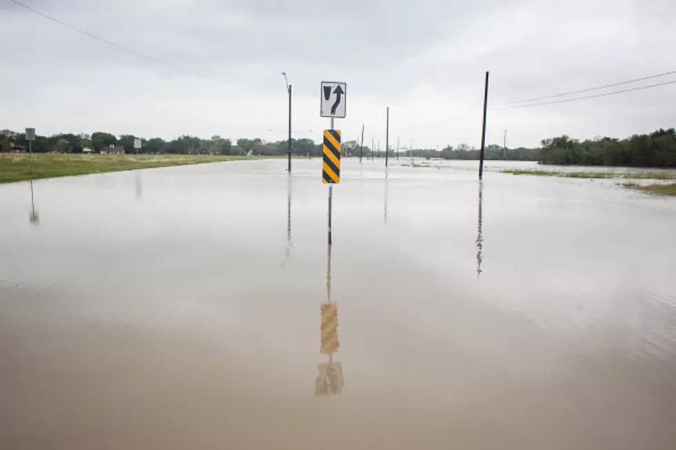
Rockford was at the epicenter of Wednesday's deluge, with flash flooding occurring all around the Stateline, near the Rt 20 corridor. The National Weather Service (NWS) estimates that 4.11 inches of rain fell at the Chicago Rockford International airport.
In fact, the NWS says that Wednesday was the third wettest June calendar day for rainfall, on record, since 1906. Here is how the rainfall mapped out:

Locations in red, represent 4 or more inches of rain.
Winnebago and Boone Counties were at the center of Wednesday's rain event, with anywhere from 3 to 6 or more inches of rain falling in less than four hours.
The hardest hit towns were:
- Rockford
- Cherry Valley
- Ridott
- Freeport
- Durand
- Pecatonica
- Winnebago
- Belvidere
The NWS issued this statement:
The flash flooding was extreme enough to cause dozens of roads to be flooded and impassable across the two counties, include parts of the cities of Rockford and Belvidere.
There were reports from Emergency Management of numerous vehicles stranded and drivers having to be rescued, as well as creeks over their banks including Kent Creek in Rockford. The 4.11" of rain yesterday at Rockford Airport easily set a new record for June 28th and was the third wettest June calendar day on record.
An Areal Flood Warning remains in effect until 11:30 AM for Winnebago and Boone Counties. Do not attempt to travel across any flooded roadways.
Photos and Videos of Torrential Rains Pounding The Stateline
Catch Mark Charvat on Q98.5 from 3 p.m to 7 p.m.. Follow him on Twitter, and Facebook
More From Rockford's New Country Q98.5


